Saturday, June 15, 2013


Bill put together this map of our travels in Florida and the Bahamas.  The red line is our trip this year.  The green, blue, orange, purple, and dark blue lines are previous years.   The red line shows how we traveled across Florida in the Okeechobee Waterway, sailed out to the Dry Tortugas, passed through the Keys to Miami, crossed over to the Berry Islands, sailed down to the Exumas with a stop near Nassau, and returned to the States by way of Eleuthra and the Abacos.

These tugs and their barges pass up and down the ICW between Morehead City and Aurora, NC traveling both day and night.  This one was too big for my camera.


We are back in our house in Kingsport.  We certainly have lots more room here compared to our 34 foot long by 10 foot wide home on the water.  We now can get out of sight of each other.  Wow.

By Saturday, June 8 Tropical Storm Andrea was well north of Charleston, SC, and it was safe to leave.  Our first plan was to motor north on the ICW because the weather forecast was for strong winds and large waves out in the ocean.  We left the Charleston City Marina and went out into Charleston Harbor.  The winds were not particularly strong and the waves were not particularly large, so we changed our minds and headed out to sea bound for the Cape Fear River.  We had only one regret, we would not be able to stop in Little River to see my sister, Elaine, brother-in-law, JP, and niece, Catherine.

We sailed overnight and entered the Cape Fear River just as the sun came up.  It was Sunday.  That meant there would be lots of weekend small boat traffic on the ICW.  The small boats can be very annoying and sometimes just plain unsafe.  I would like to have a sign that says, this 15000 pound sailboat does not have brakes.  It probably wouldn’t make any difference to the guys who tow three kids on a tube right in front of us.  Oh well, I don’t think I can fix all the world’s ills.  Our plan was to anchor for a short while at Wrightsville Beach and then head out Masonboro Inlet to sail in the ocean to Beaufort, NC.  As we were going up the Cape Fear River, we listened to the weather forecast.  Rain was predicted.  Our own 'looking-at-the-sky' forecast also said rain.  Then, it started raining.  Once again we changed our plan.  We stayed in the ICW and motored to Mile Hammock Bay arriving inside the Marine base at Camp LeJeune around 5pm.  It had been 33 hours since we left Charleston, and we were both tired.  As we were anchoring, we surprisingly saw the Austrian couple we had met in Warderick Wells anchored nearby.  We did not think we would see them again because they were intending to cruise quickly up the US east coast in order to return to Austria in August.  The four of us had our sundowners in Irish Eyes’ cockpit and told each other of our travels.

Monday, we continued motoring north in the ICW with gusty winds of 15-20 knots. The highest gust hit 32 knots!  It was a rocky, rolly trip up the Bogue Sound, past Morehead City, into the Newport River, and through the Core Creek / Adams Creek canal.  Once again our plans changed.  We intended to anchor for our last night in Cedar Creek just off Adams Creek.  The strong wind from the southwest had blown the water out of the anchorage.  Our depth sounder showed 5.2 feet where normally we see over 7.  Captain Bill looked at our chart.  “No problem.” he said, “We’ll anchor just behind the red number 6 marker in Adams Creek”.  So, we turned left out of the ICW channel at the number 6 marker, dropped our anchor, and switched on our anchor light.  I was a little worried about barge traffic going by during the night.  After all, we are so small and they are so large…  Just as I was turning out the cabin lights, I heard a barge coming.  I could hear him, and worse I could feel his engines and propellers.  I went outside to see how close the barge was to us.  Even at night the barge seemed a long way away.  We would be fine where we were.

We motored up the Neuse River Tuesday morning with a 20 knot wind on our nose.  The waves were impressive in the mile wide river, and the boat was covered with salt spray.  By lunch time we were tied to the dock in our slip at Northwest Creek Marina.  In another hour we had the air conditioner installed and running.  Nice!  Cool and dry.  After five months of damp sheets, dry sheets are like heaven.  You don’t know.  Three cheers for Freon.

The next two days were spent packing our things and cleaning Irish Eyes.  We took the evening of the second day off to have a pleasant, relaxing, and delicious dinner with Robert and Susan Banks in Oriental.

We left New Bern Thursday just before noon (and just before the temperature crossed 90°) and arrived at our house at supper time.  It was a great trip.


Come with us next time.

Friday, June 7, 2013

Leaving the Exumas and sailing to Eleuthera the water and the sea were almost matching shades of blue.  The water was so pretty.

A pod of porpoises followed us for a while in the Gulf Stream.  They moved so fast it was hard to take their picture.

This was sunrise in the morning before we got to Charleston.  Bill was asleep, and I was sailing the boat.

We were tied to the dock at the City Marina in Charleston, and Andrea was headed straight for us.  We would be together at 8am Friday.


Hello from Charleston, SC.  We have travelled a long way in the last few weeks.

On our last night in the Exumas, May 17, we anchored just off Ship Channel Cay.  Early the next morning, we pulled up the anchor and headed off for a day long sail to Royal Island.  The last time we did this we went through Current Cut.  This time we chose the Flemming Channel for variety.  We towed a Clark spoon on a steel leader thinking we might catch a fish along the way.  The steel leader would stop any toothy barracuda from biting off our lure.  We hoped to catch something around the many coral heads we had to dodge in the shallow water west of Eleuthera.  Well, we did not even get a nibble until we came out of the Flemming Channel where the depth increases from 3 meters to over 1000.  There, a dolphin fish took the lure.  We thought we had him, but the metal eye on the lure broke.  The fish got away with a hurt mouth, and we got nothing.

Royal Island was just an overnight stop for us in Eleuthera before we headed north to the Abacos.  We were up before sunrise for the 60 mile trip.  The weather forecast was for winds of 10-15 knots and seas of 3-4 feet.  Wrong!  The wind blew at about 20 knots, and the seas were occasionally 8 feet high.  To get into the protected Sea of Abaco, we planned to go through Little Harbour Cut.  It is the space between two bits of land with reefs on both sides.  Sometimes these cuts can be really, really rough.  When the wind and the waves are coming into the cut while the tide is going out it can look like a washing machine.  The locals call it a ‘rage’.  Captain Bill was worried.  When he lets me know he is worried, I am almost past worry and into deep panic.  We considered continuing on north to a wider, deeper cut.  But, as we got closer the wind dropped and the waves calmed.  We heard over the radio a boat going through the cut telling their buddy boat that conditions were not too bad.  That was good news.  We came through the cut just fine and had our anchor down off Lynyard Cay by suppertime.   It was a long and tiring day.

We stayed anchored at Lynyard Cay for several days because it was a little stormy.  During the first night, I woke Bill up so he could catch rain to fill our water tanks.  He topped off our tanks and caught another 30 gallons in jugs.  He could have slept because it rained during the next day too.  During a break in the rain we took the dinghy over to the beach and walked across the cay to the Atlantic side.  On that side the sea was really rough.  The beach was rocky, so the waves were crashing on the shore.  In the sand above the rocks we found a turtle’s nest with tracks left from the night before.

On Thursday, May 23, we moved a little farther north, anchoring in Bucaroon Bay.  The land in front of us had several small beaches separated by bits of rock.  We took a dinghy tour of each one.  To our surprise on each beach we found a different kind of shell and plenty of them.  Two were especially interesting.  One beach had lots of pieces of sea biscuits, and Bill dove just off shore for a box full of whole ones.  Another beach had a kind of beautiful pink, purple, and yellow clam shell that I had not seen before.  It was hard to leave our beaches, but we needed to move on.

We motored up to Marsh Harbour the next day.  It is the largest town in Abaco.  It even has a stop light (!) and a real airport.  Maxwell’s Grocery Store is almost the size of a small US supermarket.   We shopped, ate in restaurants, and visited with other cruisers on both our boat and on theirs.    After being anchored alone for so long, it was different to have so many boats anchored around us.  Dinghies came and went, music reached out from the nearby restaurants and bars, and the VHF radio kept up a near constant chatter.

It was time for us to think about heading back to the states.  Chris Parker is a weather forecaster who broadcasts over the SSB radio.  Boaters can subscribe to his service and talk to Chris to get a personalized weather forecast.  Being the thrifty people we are, we just listen.  There was always someone wanting to go in our direction.  His Abaco weather forecast was for windy and stormy weather all week long.  Some days he was correct, and others were just a little cloudy.  Chris’s forecast for Saturday June 1 and the days following was not too bad; a steady 10-15 knots from the south and a small chance of thunderstorms.  He also talked about the possibility of a tropical low forming in the Gulf of Mexico.  It seemed like a good time to leave Marsh Harbour, so we did.

The first day we sailed north between Abaco Island and the cays, then we turned northeast and crossed the Little Bahamas Bank.  The next day as we left the Bahamas and entered the Gulf Stream, the wind was 20 knots from behind us and the seas were rolling us quite a bit.  We could see rain and lightning all around us, but most of the time we were dry.

We were originally headed to Fernandina Beach, Florida because a cold front was expected to exit the US coast on Monday.  It became obvious that we would not make it to Fernandina Beach in the daylight, so we altered our course westward for St. Augustine.  When we left the Gulf Stream, the wind fell to 10 knots and the sea calmed down.  We turned on the motor to help us keep going.  You know, you can never please a sailor, either the wind is too strong or there is not enough.

Chris Parker’s weather forecast for Wednesday, Thursday, and Friday was pretty grim.  While the cold front had “dissipated”, the tropical low was expected to intensify and pass over Florida.  First there would be lots of thunderstorms over south Florida, then the tropical depression would sweep up the US east coast.  It was time to get out of Dodge.  Bill did some navigational calculations and said we could make it to Charleston before dark on Tuesday.  Once again we changed course.  The wind was light, so our trusty engine pushed us along with the mainsail up to lessen the rocking motion.

Out in the Atlantic we saw a pod of porpoises, several large fish, and two turtles all in one afternoon.  One night we had four flying fish land on our deck.  It was not a bad trip.  We had only one minor disaster; both of our auto pilots broke.  Fortunately, this was the last morning, so we did not have to hand steer but one day.  It was a long day.  We made it to the Charleston Harbour entrance around 4pm.  We were tied to the dock at the Charleston City Marina by 5:30, and we were cleared by customs by 6:30.  Both of us took showers with unlimited water and went out for supper before collapsing in our bunk.

Wednesday and Thursday we walked around parts of Charleston, shopped, restocked the boat, filled the fuel tank, and repaired or replaced some of the things that had broken along the way.  We had a new auto pilot shipped to us overnight.  Thursday night we went out to dinner with long time friends Louis and Cathy Boyd then waited for tropical storm Andrea to pass over us.  It was not all that bad a storm.  The wind peaked at just over 40 kt and we caught 4 inches of rain in our rain gauge.

Friday we made the obligatory trip to West Marine to buy boat stuff, shopped for presents for the grandchildren, bought still more groceries, and went out to dinner with Ed and Susan Herrington, friends from Kingsport now living in Charleston.


If the current weather forecast holds, tomorrow will be a perfect day for heading north, and we will be on our way again.

Thursday, May 16, 2013


Bill carved another year in our sign, and we left it on top of Boo Boo Hill on Warderick Wells Cay.

The Bahamian racing dinghies are wooden boats built on the beach with simple tools.  These two were in Black Point.  In previous years we have seen them raced in George Town.

The beach at Jack’s Bay Cove was covered with shells.  I could pick them up by the handful.

I’m standing on the beach at Hetty’s Land on Great Guana Cay.  Our boat and dinghy are the only things in sight.  There is not a road, a car, a house, or another soul.


Greetings once again from the Emerald Rock Mooring Field at Warderick Wells Cay, the Exuma Land and Sea Park Headquarters.

This is the spot with WiFi internet access where I posted my last blog entry.  These places are few and far between.  With a cell phone signal, my Kindle works perfectly fine for AOL and Facebook.  Bill’s ham license lets him (slowly, oh so slowly) send and receive email with the boat’s shortwave radio.  Neither one works for posting a blog or for uploading pictures.  We tried twice to get a Batelco SIM card for my old cell phone which we can tether to the PC, but for whatever reason that did not work.  So, for $10/100Mb/day we are using the park’s satellite internet link.

When we were here in April, we walked to the top of Boo Boo Hill and retrieved our sign.  It was broken and looked like someone had stepped on it.  We searched for Impetuous III’s sign from last year, but we could not find it.  Bill found a piece of wood on a nearby beach and repaired our sign adding a sixth year, MMXIII (2013).  The next day we walked back up Boo Boo Hill and replaced our sign on the pile.  Putting a sign on the hill is supposed to bring boaters good luck.  Believe me, we need all the good luck we can get.

There was a French biologist here studying the hutias.  Hutias are the only mammal native to the Bahamas.  They look like a cross between a rabbit and a rat with a rabbit’s feet and a rat’s tail and ears.  These animals were reintroduced to Warderick Wells Cay to restore an endangered species.  With no predators, they have increased in number and have rapidly eaten all the vegetation on the island.  It is amazing to see how little green stuff is left.  They have eaten all the grass and maybe three quarters of the trees.  Six years ago when we first came here, the cay was green; now it is just rocky, gray, and dead.  For us, it is sad to look at.  As the hutias run out of food, it will be sad for them as well.

Saturday night was Happy Hour on the beach at the Park HQ.  The other cruisers were an interesting group.  Among them was a young couple from Austria who sailed over from Turkey where the boat, which belongs to his father, had been in the charter service.  They were on their way to the US hoping to go as far north as New York before leaving the boat somewhere in the south for his father to pick up this fall after they return to work.  Bill loaned them some US cruising guides and gave them some others.  They gave us some Austrian sweets filled with chocolate and hazelnuts.  We plan to get the sweets back to Tennessee, but the temptation may be too great.

We left Warderick Wells and sailed south to Sampson Cay on April 29.  On previous trips we have been to Sampson Cay, but we have never taken a dinghy tour around the nearby islands that line Pipe Creek.  Over the next couple of days, we took two different tours; one up to the creek and another through the creek itself.  The water was gorgeous as were the small beaches.  On one beach I found seven conch shells.  Needless to say I was pleased.  Another day we had lunch at the Sampson Cay Club.  The restaurant had a new manager, Sonia, who did a great advertisement over VHF radio every morning.  In a voice that would do Hugh Hefner proud, she described the day’s offerings.  The food was as good as its description, and she was fun to be around.

On May 2 we motored over to Staniel Cay.  Bill bought gasoline and diesel at the Staniel Cay Yacht Club then tried without success to get a Batelco SIM data card for an old cell phone we had on board.

Early the next afternoon, the mailboat came to Staniel Cay with (among other things) food for the three grocery stores on the island.  Our plan was to have lunch at the Staniel Cay Yacht Club then walk to Isles General Store to buy our groceries.  Since this is the Bahamas and since nothing happens in a hurry, we spent the entire afternoon waiting for the groceries to be put on the shelves.  It gave us a chance to talk with other cruisers who came by, waited a while, talked a while, then giving up, left.  By 6pm when the store reopened only eight of us remained.  Patience had its rewards.  We got the first shot at the fresh food.

The next day a cold front passed over the Exumas.  We had a little rain and a whole lot of wind.  It blew 20-25 knots out of the northwest making our anchorage very rough.  We stayed on board all day Saturday just reading, knitting, and puttering about.  The wind was still howling on Sunday, but Captain Bill was restless, so we donned bathing suits and shirts and took a wet dinghy ride to the Yacht Club for lunch.  I watched several people dry off their chairs as they stood up to leave.  I was not the only person with a dripping wet behind.  The wind finally died down that evening.

It was time for us to have some clean clothes, so Black Point was our next stop.  The best coin laundry in the Bahamas is there run by a lovely lady, Ida.  I did the laundry while Bill walked around a bit.  It was Tuesday, and DeShamon’s Restaurant was having their weekly BBQ.  A couple from the Netherlands, Pim and Hanneke on Nelly Rose, shared a table with us.  We ate our fill of barbecued chicken and ribs, potatoes, corn, macaroni and cheese, salad, and freshly baked carrot cake.  The rum punch washed all the delicious food down nicely.  The food was good and the company better.

It was now the second week in May.  Our time in the Bahamas was getting shorter.  Walking on deserted beaches looking for shells is my favorite thing to do here in the islands.  Bill and I decided to adopt the beach a day plan.  South of Black Point, there is not another settlement on the remaining ten miles of Great Guana Cay.  There is just one beach after another separated by rocky shores.  Perfect!

Let’s see, there’s Little Bay, Jack’s Bay Cove, Jack’s Bay, White Point, Hetty’s Land, Isaac Bay, Bay Rush Bay, and Kemps Bay all with undeveloped white sand beaches before you reach the end of Great Guana Cay.   We strung them together anchoring at Little Bay, Jack’s Bay Cove, Jack’s Bay, Bay Rush Bay, and Hetty’s Land.  By dinghy we visited White Point and Isaac Bay.  We also explored the rocky shores between the beaches ducking into a limestone cave and scouring among the rocks for cone shells.  In three different places we walked across the island to its other shore to watch the surf break on the windward side.  One day Bill took the dinghy to the next island south, Little Farmers Cay, to take Terry Bain a book and bring back two freshly made Jimmy Buffet recipe cheeseburgers with fries for lunch.
 
Two spots were especially memorable.  The beach at Jack’s Bay Cove was covered in shells.  I had onboard a sieve and trowel I have used to find shark’s teeth in North Carolina.  I scooped up a wine box full of unsorted small shells for a grandchildren’s crafts day that we will have when we get home.  The beach at Hetty’s Land was dotted with sand dollars.  We easily picked up over fifty white ones and did not even attempt to count the brown, live ones we left behind.

In the end we failed at the beach a day plan.  At several of the spots we stayed an extra day or two.

Over the next few days we will head north to the Abacos and spend some time there.  Then we will begin the trip back to the states.  As always, everything depends on the weather.

Friday, April 26, 2013


Leaving Government Cut the skyline of Miami begins to shrink in the distance.

This bird rode for with us for a while in the Gulf Stream.  We could almost touch her.  I think she is a Northern Parula, a kind of warbler.  I hope she got home.

This building with the interesting roofline is Momma and Papa T’s Beach Club on Great Harbour Cay in the Berry Islands.  The door was open, and the beer was cold.

Bill is prowling about looking for conch in the shallow grass flats at Normans Cay.  The ditched drug running aircraft we snorkeled on during our first trip here is underwater near the top left of the picture.

We kept and cleaned two of the conch he found.  Bill is holding one shell and one corpse.  The other is on our stern seat which doubles as a fish cleaning table.  These huge snails just drip slime.

Beaches, beaches, beaches.  That is what these trips are about.  These are the sand flats just north of Hawksbill Cay at nearly low tide.  Ten football fields would not begin to cover them.

This second beach picture is at Shroud Cay.  Use Google Maps and search for spot where we anchored,  24°32.882'N 076°47.479'W  , zoom in, choose satellite view, and go northeast to find the beach on the east side of the island.


A big Bahamian hello to you all.  It has been quite a while since I last posted an entry.  We have been without internet for the last two weeks.

When I last wrote we were anchored off Miami’s South Beach.  We had a plan for traveling to the Bahamas.  We would sail from No Name Harbour on Key Biscayne leaving for Bimini at 3 or 4 in the morning.  In order to do that, we would have to move the boat from South Beach to No Name.  But, before we could do that we needed to do the laundry, fill the boat’s water and fuel tanks, buy the last of the beer and Diet Cokes that would fit in the quarter berth, shop for groceries, get some gin… you know, the usual departure list.  It would be a busy but doable day.  I did our laundry early in the morning of April 1st while Bill got the water, gin, and fuel.  The laundry was finished before Bill went to get the last jug of fuel.  I still needed to get the groceries, so Bill dropped me off at the dinghy landing spot to walk to the Publix grocery store.  He took my clean laundry back to Irish Eyes and picked up the empty fuel jug.  Bill got the fuel, took it to the boat, and was coming to get me at Publix when our plans fell apart.

Some of you have probably heard Bill say “Want to make God laugh? Just make a plan”.  Well, while I was in the grocery store and Bill was riding in the dinghy, the previously beautiful sunny skies clouded over and a huge thunderstorm developed with lightning and drenching rain.  Bill was trapped in the dinghy under a bridge, mostly dry but being slowly dripped on.  I was outside Publix waiting on him.  I talked to a nice guy, who had jogged to the grocery store and was afraid to jog back in the rain for fear of getting his cell phone wet and to an older gentleman, who did not like to drive in the rain.  The jogger was from Raleigh originally, and the older gentleman was interested in how we lived on a sailboat.  The bench was dry and the company entertaining.  Poor Captain Bill; he got soaked.  By the time Bill made it to Publix it was 2pm.  It was still raining, thundering, lightening and the wind was blowing hard.  We ate our very late lunch at the Publix deli, waited around some more and finally gave up and walked and dinghied in the rain back to Irish Eyes.

We were both soaked and cold, but a hot rum toddy (or two) quickly warmed us up and restored our spirits.  It was after 4pm by this time and still storming, so the trip to No Name Harbor was cancelled and our plans were ruined.  We were worried about when we would be able to leave Florida.  The next day, Tuesday, was just about the only good weather day to cross the Gulf Stream and the day after, Wednesday, was the only good one to proceed farther south in the Bahamas.  If we left a day late, on Wednesday, we could make it to Bimini, but the approaching cold front would catch us there, and we would be stuck.  What to do, what to do?  I made a suggestion that we could leave the next morning from Miami, sail overnight and arrive at Great Harbor Cay in the Berry Islands early on Thursday beating the cold front.  Captain Bill was dubious.  We went to bed without making a decision.

After a night’s sleep, Bill decided my idea was his idea.  We pulled the dinghy out of the water and pulled up our anchor around 10am.  There were not any cruise ships in the Miami harbor, so we breezed out Government Cut and left Miami behind.

The wind was light, and we were motor sailing, enjoying the indigo water in the Gulf Stream and the sunshine.  We were several miles out to sea when a little grey and yellow bird appeared in the cockpit.  It was not afraid of us at all, even landing on the bird book I was using to identify it.  Bill gave it a section of a tangerine which the bird pecked at for a bit.  It stayed with us for about an hour and then flew away.  I decided it was migrating and just needed a rest and a little snack.

Our overnight trip was uneventful.  When the sun came up we could see the beautiful blue water of the Bahamas.  We arrived at the Great Harbor Marina about lunch time.  The customs and immigrations officer came to the marina.  We did not have to go to him.  The strong cold front was still coming our way, so we stayed in the marina for three days.  There were about half a dozen boats there either just arriving in the Bahamas or headed back home.  We enjoyed meeting several couples over food at the marina, and one night we walked into Bullocks Harbour and had our first conch dinner of the trip at Coolie Mae’s wonderful restaurant.

The cold front finally came through on Friday with wind and rain.  It was gone by Saturday morning, so we left Great Harbour Cay headed north to the top of the Berry Islands then south on their east side to Little Harbour Cay.  The trip around the north end of the island put us in the Northwest Channel which was anything but smooth.  The waves were huge.  We had to go around two cruise ships anchored off their prettified private islands.  I do not know why cruise lines do not use the local businesses; it seems so wrong to build a fake Bahamas when the real one is right there.  We made it to our anchorage off Little Harbour Cay where there was not a thing in sight but sand and water.

The next leg of the trip took us to West Bay on New Providence Island. Coming out of Little Harbour was terrifying.  We had the tide going out and the wind blowing in, that meant monstrous waves.  The bow of Irish Eyes would point at the sky one moment and at the center of the earth the next.  It felt like we were not moving.  Finally, we made it out and sailed southeast toward New Providence Island and Nassau in much more sedate (?) 4 and 6 foot waves.  A few hours later we were anchored in the calm waters of West Bay several miles from Nassau enjoying the faint Reggae music from the two bars on shore.

In the morning after the sun rose high enough to see the coral heads in our path, we left West Bay and motored upwind to Highborne Cay.  It was a long day, but we made up for it by staying at Highborne for three days.  After lounging about like snails the whole first day, we were finally rested enough from our labors to launch the dinghy and do some beach walking.

On these trips to the Bahamas we are slaves to the weather.  We basically live outside, and the weather controls everything.  On our third day at Highborne Cay the wind changed in direction a bit, waves entered our anchorage, and the boat began to roll, so we moved a whopping 6 miles to Normans Cay and anchored off the west side beach.  We dinghied around the south end of Normans to the sand flats on the east side of the island.  The scenery was spectacular.  Bill decided he wanted to go conching.  Conching is not hard, the conchs put up no resistance, they don’t move fast, you can easily catch them (You just lean over and pick it up.), but finding them is another story.  Bill found five conchs.  (I found lots of shells.)  We kept the two largest conchs.  Bill did a good job getting the slimy things out of their shells, and I did an okay job of cooking them.  Other than to have had the experience, I think I will continue to have my conch in a restaurant.

It was time to move on, and we made another “long” trip of about six miles to Shroud Cay.  Shroud is in the Exuma Land and Sea Park.  The island is an uninhabited ring of rock with mangrove swamps and sand flats in the middle and with beaches scattered around the outside.  There are several creeks that pass through the island winding their way through the mangroves and past the sand flats to beaches at each end.  We spent six days touring the creeks, snorkeling on offshore coral heads, and beach walking.  Bill got water from a well that is almost at the highest spot on the island, and he dug up nearly a hundred pounds of scrap iron from below the sand on one beach.  No gold, just iron.  It was great.

This year we do not have a schedule to keep, so we are moving slowly down the Exuma island chain.  Hawskbill Cay was our next port-of-call; another six mile trip.  Like Shroud Cay there is not a thing there but water and sand.  Bill and I took several dinghy trips around to the north side of the island to explore the caves, sand flats, and beaches.  We had a rainy day on Monday April 22.  It gave Bill a chance to use his fancy-dancy rainwater collecting system.  We topped off our tanks and put another 25 gallons of fresh water in jugs.  Several boats came and went while we were at Hawksbill, but a large motor yacht was there when we got there and was still there when we left.  Someone on that boat apparently had a birthday on our last day.  They had a party on the beach complete with balloons, a bonfire, dinner ashore, and fireworks.  While we did not receive invitations to the party, we did enjoy the fireworks.

We left Hawksbill Cay on Wednesday, April 24 sailed for the Emerald Rock mooring field at Warderick Wells Cay; the Exuma Land and Sea Park Headquarters.  The wind was strong from the northeast, and we were headed south, so it was an exhilarating sail.  The fifteen mile trip only took us just three hours!

One of the nice things about the Park Headquarters is wifi.  We will spend a couple of days here catching up on our email, internet banking, and web surfing, finding our sign on Boo Boo Hill, and enjoying the beaches and trails.

Hope you are all as well and happy as we.

Monday, April 1, 2013


This was one of the stones in the Key West cemetery.  They say she was a hypochondriac.  I wonder.

Most cruise ships are just cruise ships, but Club Med 2 has sails (even if they seem a bit small for the ship).

Welcome to South Beach. 

We took a dinghy tour through the South Beach canals looking at the houses and the boats tied up out front.  It doesn't look too shabby does it?


Happy April Fool’s Day from South Beach, Miami, Florida.  Bill and I have been here for a week seeing the sights and getting ready for our trip to the Bahamas.

One of the last things we did in Key West was take a tour of President Harry Truman’s Little White House.  It was a nice place.  The house was not large, four bedrooms, and looked like a pleasant 1950’s summer home.  I think we saw all the sights in Key West, but mostly we saw lots of people --- lots and lots of partying people.

We left Key West on Tuesday, March 19 early in the morning.  After motoring out the channel, we unfurled our sails and headed east through the keys to Marathon.  The wind was predicted to be 5-10 knots, but that was wrong.  It was 20.  The sky was overcast, and we had a very light, intermittent rain along with the 20 knot breeze.  We flew along for a while, but the wind died as the sky cleared.  The last 2 hours of our 10 hour trip were spent motoring.  We arrived at Marathon just as the marina was closing, but we were in time to be assigned a mooring ball.  Even with everyone on the nearby boats watching and the tension high, picking up the pennant on the mooring ball was child’s play with the mooring ball grabbing hook Bill made for me.

The mooring field at Marathon is in Boot Key Harbor.  It is a huge and well run operation.  There are 200+ mooring balls.  Some cruisers spend the entire winter in Boot Key Harbor.  They have showers, a laundromat, water, fuel, and as best we could find, the only dinghy dock in the harbor.  In the town of Marathon are grocery stores, Kmart, Home Depot, and a West Marine (without a dinghy dock).  The boaters in the harbor have a morning cruiser’s radio net.  It is where one can hear all the local boater news.  Some folks have been in the place too long and have begun to care about trivial stuff, really trivial stuff.  We listened to a half hour radio discussion of the merits of various shopping carts, hand trucks, and trolleys that could be used to wheel groceries the mile from Publix to the marina.  Everyone had a different opinion.  It just went on and on and on…  I did laundry (hopefully washing our long underwear for the last time) while Bill walked all over town.  Our dinghy had developed a small leak in the floor, and Bill was looking for the perfect glue to repair the dinghy.  We went to two pot luck Happy Hours and met some great folks (who did not discuss shopping carts).

On Saturday, March 23 it was time to head on.  We motored out of Boot Key Harbor and then sailed east to Rodriguez Key near Key Largo.  The sun was shining and the water pretty.  We had one of those perfect sailing days.  We anchored just a bit before the sun set behind Rodriguez Key.

The next day we were up and away before 8 o’clock as the sail to South Beach would be fairly long.  The wind was strong, 20-25 knots with gusts to 28 knots.  We raised only the reefed main and sometimes even that was too much.  The wind changed directions in the afternoon causing the main to jibe breaking a main sheet block.  That meant the sail unintentionally went from one side of the boat to the other making a big racket.  The sail ended up plastered against the rigging until we could replace the broken block.  The wind kept picking up.  We were a couple of miles away from the Miami Harbor entrance when we heard over the VHF radio that the nice, wide Government Cut main channel was closed because there were two cruise ships there.  That wasn't a problem; we would just go up the smaller parallel channel on the other side of Dodge Island.  Just as we were approaching the jetties at the harbor entrance, a cruise ship was leaving.  Captain Bill was still sailing full speed.  I suggested we start the motor, and we did.  The wind was blowing at about 25 knots straight in our faces after we turned between the jetties and into the entrance channel.  There was a second cruise ship, then a car ferry, then other sail boats, then a tour boat, then a tug with a fuel barge strapped to its hip, and everywhere were jet skis, sport fish, and Donzi boats going in both directions.  Let me tell you about just one of the jet skis; two young males on a red one.  They stopped right in front of the second cruise ship.  One of the males hopped in the water.  The other male jumped in the water.  I thought there was something wrong with the jet ski and they were going to push it out of the way of the approaching cruise ship.  I worried the guys would push the jet ski either in front of us or into our side.  Then both males got out of the water and started doing flips back into the water!  They were swimming in front of a moving cruise ship!  Ever heard of survival of the fittest?  I literally could not watch, so I can’t tell you what happened.

We got our sail down, and continued along the channel.  The wind was howling, and the waves from Biscayne Bay and the wakes from all the boats bounced off both the concrete walls and the docked container ships.  The place was a total washing machine.  We made it to the end of the Dodge Island Cut only to discover that the Miami Ultra Music Festival was in full swing at Bay Front Park.  The music was deafening, we could not hear our radio, and a police boat with flashing blue lights was minding the dozens and dozens of boats filled with party-goers anchored or slowly motoring around in the channel.  We had to weave our way through the chaos.  Irish Eyes is not fast and does not make changes in direction quickly, but we managed to find a way through the fleet.  After passing under an open railroad bridge and two fixed highway bridges, we turned right into the relatively calm waters between the McArthur and the Venetian Causeways.  The wind was still blowing hard from the northeast, so we elected to anchor in the clam lee of Hibiscus Island.  It was a double rum ration night.

We have been busy both sightseeing and provisioning (that is a fancy nautical term for buying food and other things) for our trip to the Bahamas.  Of course we have been to West Marine, but we have also checked out a traditional marine chandlery, Crook & Crook, a hardwood lumber yard, Shell Lumber, and a used sailboat junk store, Sailorman.  We've ridden the buses  trains, and the Metromover on trips to both in Miami and Ft Lauderdale.  Bill has used the dinghy to haul fuel, water, cokes, and beer out to the boat.  I've been grocery shopping and have once again done the laundry.  Our winter clothes have been packed and shipped to our daughter Ann’s house.  We've eaten in restaurants and done some serious people watching.  Bill bought a couple of used books at the Out of the Closet Thrift Store.  South Beach has been a good place to stock the boat and have a little fun, too.

We’ll leave for Bimini tomorrow morning if the weather cooperates.

Saturday, March 16, 2013


Friday, March 15, 2013

There is an alligator underwater sneaking up on this egret.  Will the egret see it in time?

Usually, locks have underwater valves that are used to fill and empty the locks.  The Okeechobee Waterway locks don’t have valves.  The gates are cracked open, and the water gushes in.

With an opened vertical clearance of 49’ this Florida East coast railway bridge sets the height limit for the Okeechobee Waterway.  The tip of our masthead antenna is 45’-9” above the water.

This is Thomas Edison’s banyan tree.  It is taking over his yard.  I don’t know how you would prune it.

Sunset on Ft Myers Beach with a sailing ship offshore.  The spring breakers have left for the bars.


These are pictures of Ft Jefferson inside and out.  You have never seen so many bricks.  The fort covers almost all of Garden Key.  They could not have made it bigger.  Dr Mudd was imprisoned here.

Poor Bill.  He came all this way and the island was closed.  Actually, it was a nesting site, and we were not allowed to disturb the birds.

The end of the road in Key West, Florida.. You can’t go any farther.

Hello from Key West, Florida.  It is sunny and fairly warm, but boy has it been windy here.

I last wrote from Vero Beach. We spent our last full day in Vero Beach taking showers, doing laundry, having lunch with a friend from Kingsport, buying groceries, and finally ending the day at a cruiser’s potluck party at the marina.  It was a busy but fun day.

We left Vero Beach on Friday, February 22 headed for Stuart.  The weather forecast was for sunny skies and wind of 5-10 knots, so we decided to tow the dinghy.  We had the sunny skies, but the wind was more like 15-20 knots with gusts up to 24 knots.  Not good for towing the dinghy.  The little boat enjoyed (?) a wild ride.  The waterway to Stuart was narrow, shallow in spots, and had lots of Friday boat traffic.  Irish Eyes’ keel touched the bottom three times.  The sun was setting when we dropped our anchor across the St. Lucie River from the mooring field in Stuart.

Bill got me out of bed before sunrise.  We put the dinghy on deck since towing it through the locks of the Okeechobee Waterway would not be a particularly bright idea.  The second bridge on the waterway was a new 64 foot high-rise that was still under construction.  The bridge was closed to boat traffic from 10am to 4pm.  Since we were up well before 10am, this did not cause us any problems.  The first set of locks raised us 15 feet.  The locks on the Okeechobee Waterway were filled by cracking the upper gates and letting the water pour in.  Seeing a 15 foot high torrent of water cascading towards us through the partially open gates was quite impressive.  Irish Eyes and her crew did just fine as the water crashed and bubbled ahead of us.  The river after the locks was a canal with little to see except fields, cows, birds, and trees.  Our anchorage for the night was a little drainage ditch which branched off the side of the canal.  We reached it by 2pm.  It was a very nice spot, and it was refreshing to have a short day.

Sunday, February 24 dawned very foggy; pea soup foggy.  I managed to convince Bill to stay anchored till the fog lifted at least a little.  He got antsy; we pulled up the anchor and started down the canal.  Bill was washing off the anchor, and I was steering.  I could not see either bank of the canal from the middle, so I whined enough for Bill to agree to return to our drainage ditch and anchor for a while.  By 10 o’clock, the fog lifted, and we were off again.

The locks at Port Mayaca let us down a few inches, and we ventured out onto Lake Okeechobee.  It ended up being a warm clear day, and the trip across the lake was uneventful.  The lake was wide, and we felt like we were out at sea.  The shoreline was not visible until we entered the channel leading to the canal on the other side.  The canal was bordered on one side by a park built on the top of a high levee and bordered on the other by undeveloped land.  It was all much different from the east coast of Florida.  We anchored for the night just out of the main channel near an abandoned fish camp.  I watched an alligator try to catch a great egret, but the bird saw the stalking ‘gator and flew away squawking.  Whew, was I worried.

Passing through the third set of locks at Moore Haven and the fourth at Ortona took us from the level of Lake Okeechobee to the level of the upper Caloosahatchee River.  It was a non-event.

Along the banks of the Caloosahatchee River were herds of cows.  The vegetation was green but not exactly lush.  The cows looked healthy enough, but I wondered what they really ate.  The town of LaBelle had a free city dock, and we decided to stop there for the night.  We needed a few groceries, and Bill wanted to check out the hardware store.  To tie to the dock, we had to “med moor”.  On a sailing trip in Greece twenty years ago, we had “med moored”, but we had never done it in Irish Eyes.  One hundred and fifty feet from the dock, Bill was to drop the anchor off the stern and motor bow first toward the dock feeding out anchor line as we went.  I was to grab the dock off the bow at exactly the instant Bill stopped the boat with the anchor.  Sounds easy, but I was nervous especially because we were trying to slip Irish Eyes in between two already moored boats.  Thankfully another boater on the dock took my line, and I did not have to hop off and tie our bow to the dock.  We walked into LaBelle to do our shopping.  The local honey merchant claims to have over 900 varieties of honey.  I am not sure about that, but I bought some wildflower flavor.  We spent a pleasant evening tied to the dock.

A cold front was to pass over western Florida the next day, so we decided to stay.  That was okay because the city allows docking for up to 72 hours.  Bill walked to the hardware store to look around while I lazed about on the boat.  The front came over us as the sun was going down.  It rained and the wind blew.

Wednesday, February 27 was beautifully clear, but it was a little cooler than the previous few days.  A manatee was swimming in the river behind Irish Eyes as we were getting ready to leave LaBelle.  The huge beast very slowly moved away, and we set off down the river.  We went through the fifth and last lock and through several draw bridges ending the day anchored in the Power Plant Sluice near Ft. Myers.  In spite of the name it was a nice place to anchor.  Surrounded by mangrove covered banks, we could neither see nor hear the nearby power plant.

It took us only a few hours to go the great distance of 15 miles to the Ft. Myers’ City Marina mooring field.  We tied to a ball and took our dinghy to the marina before noon.  We had a nice lunch at an outdoor cafĂ© in the River District.  It was almost 80 degrees at long last.

Ft. Myers was the winter home of both Thomas Edison and Henry Ford.  Harvey Firestone was one of Edison’s friends and a frequent visitor to Ft. Myers.  We walked out to the Edison/Ford estate after lunch.  The houses were not mansions, but very nice Florida cottages.  The grounds were full of tropical plants.  Edison was interested in making synthetic rubber from plants, so he grew all sorts of things.  His wife was a keen gardener, and I think she kept things under control.  If you are ever in Ft. Myers, the estate is well worth a visit.

Once again a cold front was to pass over western Florida.  The captain made the decision to stay in Ft. Myers through the weekend.  That was fine with me.  The downwind dinghy ride to town was not bad, but the upwind (and up wave) return trip was wet and cold.  We did go back into town twice, but on Sunday it was very windy, and we just stayed on Irish Eyes.  I spent the day watching my DVD of Downton Abbey’s third season.  Bill read.

Monday morning March 4 was clear and cold.  We suited up in several layers of clothing, untied from the mooring ball, and headed downriver to Ft. Myers Beach.  The trip took us out into the Gulf of Mexico for a bit and then back into the river behind Estero Island.  When we got to the Ft. Myers Beach mooring field, we found it very confusing.  Captain Bill said “Go below and call the phone number on the bottom of the page in the open guidebook on the nav desk and find out what we need to do.”  (Now, you noticed that he did not say left page or right page?)  I went below and called the number on the bottom of the left page. It was highlighted, bold, and really stuck out.  I spoke with a very nice person in the Florida State Parks Office who did not have a clue what I was talking about.  After some consultation with the captain and an increasing amount of ‘marital bliss’, I found the correct number which was buried in a paragraph near the bottom of the right page.  While this slight misunderstanding was going on, we ran aground in a part of the mooring field that was too shallow for our 5 foot draft, backed off, and played dodgem in the current with a red daymark.  We finally picked up a mooring and each had a beer (or so) to ease the stress.

The winter weather in Florida changed as cold fronts blew down from the plain states.  It was warm for a couple of days, then cool for a couple of days.  Tuesday was warm and sunny.  We walked over to the beach to find lots and lots of people basking in the sun.  It was Spring Break somewhere (or more likely lots of places).  Wednesday was just as sunny, but it was windy with temperatures in the 60’s.  We rode the local bus first to the mainland and then from one end of the island to the other and back again jumping off twice to check things out.  It might have been windy and cool, but the girls on Spring Break were not admitting it.  They wore bikinis while we wore long pants and sweatshirts.  Late in the afternoon a friend from Tennessee, Clarke Lucas, arrived.  He was visiting his friend Bruce Bartlett on Bruce’s boat, Roamer.  We all spent the afternoon in the cockpit of Irish Eyes chatting.  Clarke also brought us our accumulated mail that Richard Barr had retrieved from the post office in Kingsport for us.

Back in December, we had bought three updated chart cartridges for our chartplotter giving us charts from Norfolk to Lake Pontchartrain including the Bahamas and Bermuda.  Just out of New Bern, we found the first card to be bad.  It was replaced by a set of new cards sent to us in Vero Beach.  Crossing the Okeechobee we switched to the second new card and found it also to be bad.  C-Map agreed the software was again not correct and sent another set of replacement cards to Ft Myers Beach.  We had to wait on them to arrive Thursday morning before we could leave, but finally we were underway by 1pm.

Our destination was Ft. Jefferson in the Dry Tortugas which would be a 26 hour trip.  The wind was forecast to be from the northeast which would make the southwest trip easy.  NOAA got it wrong.  The wind was from west making the trip to the Dry Tortugas a beat.  We briefly considered skipping the Dry Tortugas and going instead to Key West, but we did not.  We hoisted a reefed main and the genoa, buried the port rail in the water, and sailed for the Dry Tortugas… spray flying and sailing on our ear; not what I like.  As the afternoon wore on and continuing through the night, the wind slowly shifted around to the northeast.  Sailing downwind would have been great, but the waves kept coming from the west or northwest and rolled us from side to side and back again.  It was really hard to sleep.   I would just drop off to sleep and the boat would roll and startle me awake.  It was cold.  On watch I had to wear long underwear, socks, and my winter coat.  The waves were forecast to be 2 feet high, but they ended up being more like 4 feet.  It was rolly, rolly, rolly.  There were lots of stars to see, but I still am not a fan of sailing in the dark.

We arrived at Ft. Jefferson in the early afternoon and went straight to sleep.  Ft. Jefferson is a large pile of 16 million 19th century bricks in the middle of nowhere.  There are two major keys there, Garden Key on which Ft. Jefferson sits and Bush Key which is a bird sanctuary.  The two islands used to be separate, but sand has filled the gap, and they have become one.  A flock of sooty terns and the brown boobies nest on Bush Key this time of year.  Thousands of them along with dozens of frigate birds that eat the hatchlings kept up a constant din.  It sounded like the soundtrack from Hitchcock’s film, The Birds.  We spent three days walking around the fort and enjoying the scenery.  One night as the sun was setting a commercial fishing boat came along side and said they would trade fish for a six pack of beer.  I quickly put a plastic grocery bag filled with six of Bill's beers on the end of their boathook; they replaced it with another bag filled with 6 whole yellow tailed snappers.  So far, we have eaten just one which made two meals; baked fish with veggies one night then fish stew with veggies the next.

Our plan was to leave Ft. Jefferson for Key West.  We planned to stop at the Marquesas Keys to break the 70 mile trip into two near equal lazy days.  The Marquesas Keys are just some little mangrove covered islands in the middle of the ocean, and we could spend a few hours exploring them.  But, there was the weather.  It did not like our plan.  A cold front was coming.  High winds and high seas were predicated.  Our plans changed, and Tuesday morning at sunrise we were underway bound for Key West without a stop.  Key West came into view long before we arrived.  We first went generally south in the Northwest Channel, then north in the Ship Channel and through Man of War Harbor, the finally south again in the Garrison Bight Channel.  I think we spent three hours arriving.  It felt like driving into New York City and getting stuck in a traffic jam; so near yet so far. It was a long day, but at sunset we were tied to a mooring ball in Garrison Bight at Key West.

The wind blew for two days, but today it calmed down quite a bit.  It was cool but not cold.  The Key West natives act like 65 degrees is 32 degrees below zero.  The radio is full of whining about the weather.  Bill and I have made a couple of walking trips through town.  A Carnival Line cruise ship was here along with all the kids on Spring Break, so it was crowded.  The shops all had Spring Break 2013 tee-shirts for sale.  I was just happy to be warm and lucky enough to be sailing along with my sweet husband.

The plan is to head north through the Florida Keys to Miami and then head to the Bahamas.

Stay warm and think SPRING.

Wednesday, February 20, 2013


Wednesday, February 20, 2013

I’m on the Cumberland Island Beach with palm trees, white sand, and sun.  Finally, we are far enough south here in the southern corner of Georgia to be warm.

Bill stopped on his way back to the boat on this Cumberland Island trail amid the palms and Spanish moss covered live oak trees.

Anchored in Florida at last, but the weather in Fernandina Beach did not match the latitude.  In the evening the town’s waterfront disappeared in the fog.  The next day brought both tornado and thunderstorm warnings.

The bridge across the ICW in St Augustine is called the Bridge of Lions.  This is one of the lions.

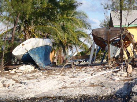
Outside Stewart’s Market in St Augustine a truck of oranges waits to be unloaded.  Stewart’s is a grocery store like they were before they became supermarkets.


I am typing this as we motor down the Indian River between Melbourne and Vero Beach Florida.

First, let me tell you part of the water pump pulley story.

Bill was worried about the superglued together pulley on the raw water pump on the engine.  He called three Yanmar dealers along the way looking for a replacement.  In Myrtle Beach, Hague Marina didn’t have one in stock.  In Georgetown, Hazard Marine did not return two phone calls and did not answer the radio as we cruised by their dock.  In Charleston, Charleston Boatyard did not have one in stock either.  Bill gave up looking and ordered a pulley from an internet dealer to be delivered to Beaufort, SC.  For good measure he also ordered a complete pump assembly from a boatyard in Massachusetts to be delivered to us in Vero Beach, Florida.

Now with that out of the way, I’ll go back to our 2013 cruise where I left the story in the Coquina Yacht Club in Little River, SC.

A spot off the ICW behind Butler Island in the Waccamaw River north of Georgetown was both scenic and an easy day’s travel from Little River.  It was our first stop on this next leg.  Our second stop after Little River did not go as well.  We pushed on until sundown to reach Seven Reaches Creek north of Charleston.  That did not work out at all.  With the tide nearly low but still falling and the sun going down, we hit the bottom twice trying to enter the creek where the chart plainly showed 7 feet.  Abort.  We backtracked and anchored in the familiar-to-us spot in Dewees Creek not far from the Dewees Island ferry dock.  The sunset was spectacular, but the air temperature dropped like a stone as the sun went down.

Sunday morning, February 3 was clear but very windy.  NOAA had small craft advisories for Charleston Harbor.  We, being the aforementioned small craft, stayed safely anchored for the day.  I knitted and read.  Bill, who could not cruise south, cruised the internet instead.  As forecasted, it was cold and windy.  It was a day much better spent at anchor than motoring south.

Our third night was anchored in another familiar spot, just off the ICW along the banks of the South Edisto River near Fenwick Island.  Everything was fine until Bill logged onto the internet only to discover that the pulley from the internet dealer had not been shipped because the credit card had failed.  Oooh, was he mad.  There was nothing he could do till morning.  After two phone calls to the dealer, the credit card number that had not worked before worked.  The pulley would be a day late getting to Beaufort.  We would have to spend the night there rather than just stop, pick up the pulley, fuel the boat, and go on.  It all worked out better than he thought it would.  February 5 was his 62nd birthday.  I gave him his present (a fancy hand held GPS), he got a nice meal at a waterfront restaurant in town, and he got to go shopping for the list of things that he had left Kingsport without.  The phone rang with friends and family wishing him a happy birthday.  Not a bad outcome.  For my part I bought postcards and mailed then to the grandchildren.  Then, I visited the local knitting store buying yarn for another project that I had been thinking about.  (One can never have too much yarn.)

With full fuel and water tanks and with the new pulley firmly bolted in place, we were off to Georgia.  It was warm enough not to wear a coat.  We passed Hilton Head Island and anchored in a beautiful spot on the New River just north of the Georgia state line.  All we could see for miles was marsh grass with the industrial works along Savannah River rising above the grass in the distance.  Just as the sun was setting, we watched two tugs and their barges, one northbound and the other southbound, maneuvering through a skinny spot in the ICW behind us.  It was impressive to watch the skillful captains as we listened to them talking on the VHF radio.

Thursday, February 7 dawned gray and cloudy.  NOAA predicted rain off and on all day.  Bummer.  I like the warm sunshine better.  We pulled up the anchor early in the morning to catch high tide in a shallow spot in Field’s Cut just before the Savannah River.  Across miles of marsh grass we watched one ship pass down the river in front of us, and on the VHF radio we listened to another headed our way up the river.  We got across the river and back into the ICW without a hitch.  I would like there to be traffic lights at river intersections.  Irish Eyes is so small; the ships are so big.

The forecasted rain began as we passed the cemetery at Causton Bluff.  The cemetery was beautiful from the water.  The live oak trees were huge and the Spanish moss was everywhere.  One of our guide books said John Muir thought it the most beautiful spot in Georgia.  Beautiful or not, it was still raining.  We passed Moon River, and it was still raining.  I did not sing the song.  It was pretty miserable; wet and cold.  We decided to turn off the ICW and into the Vernon River.  We anchored even though it was just lunchtime.  Bill did some boat chores.  I knitted, read, and cooked chicken with apples and sweet potatoes for supper.

The next morning was gray.  The top of the nearby cell tower was invisible in the low hanging clouds.  It was just gray, gray, gray.  We motored through the shallow spots at Hell Gate, The Florida Passage, and Creighton Narrows making it to the South River near Darien, Ga. at sunset.  That put us just north of the shallow and aptly named Little Mud River.

Saturday, February 9 was clear but cool.  The tide was high and we transited the Little Mud River without a problem.  We stopped at the south end of St Simon Island outside of Brunswick early in the afternoon to wait until the next day’s high tide to go down the shallow Jekyll Creek.  Bill did some more boat wiring chores.  I often wonder if he will ever run out of boat chores.  What will he then do for entertainment on these trips?

We motored through Jekyll Creek never coming close to striking the bottom.  As we went out into St. Andrew’s Sound, we unfurled the genoa and motorsailed behind Cumberland Island and into the Brickhill River.  We anchored just off the Park Service dock at Plum Orchard Plantation, one of the remaining Carnegie mansions on the island.  The weather was sunny and much warmer.  We took the dinghy ashore and walked the two miles across the island to the ocean side beach.  I even took off my shoes!  We found several whelk shells, actually lots and lots of whelk shells, but I left some behind.  We had the place almost to ourselves.  It was a nice day.

For a change of scenery we moved to a spot off the Greyfield Inn at the southern end of the island.  The guidebook recommended the position to anchor and spoke eloquently of the inn – the most exclusive inn in the country, the spot where John F. Kennedy, Jr. was secretly married.  The inn may have been great (we never went), but the anchorage was lousy.  It was narrow and deep, and the water flushed through like a river.  Being ourselves less patrician and more egalitarian, we moved to a much better spot off the Boy Scout Sea Base Dock.  We again went ashore walking over to the beach on one trail and back by the ruins of Dungeness on another.  It was a very nice walk.  The south end of the island had more visitors than the north end.  We saw several tour groups.

This was our sixth trip south through this part of the ICW in Irish Eyes, and if you add our trip on Canary, our 22 foot sailboat, it’s seven times we have passed Fernandina Beach without stopping.  We decided to stop this year.  We walked through the restored town centre looking in the shops and at all the stuff we did not need.  Two of the things we did need were lunch and something to drink.  An Irish Pub promised both, so in we went.  A little farther along (and not matching the early 1900s theme of the restored downtown) we came to the discount store Fred’s and bought a few groceries.  It started raining, so back to Irish Eyes we went.  The rain did not last long, so we made a late afternoon trip back to town just for exercise.  It was seriously foggy by the time we got back to Irish Eyes.  We had a movie night aboard the boat -- Lawrence of Arabia.

On the 13th, the weather forecast had a tornado watch in the morning and high winds and thunderstorms in the afternoon.   We were chickens; we stayed where we were anchored.

Valentine’s Day dawned rainy but not as windy as the day before.  Bill gave me a small box of chocolates.  I was impressed he had managed to buy it without me knowing and keep it hidden on this small boat.  Way to go Bill.  We motored in the intermittent drizzle to Vilano Beach just north of St Augustine.  Just after we anchored the rain began in earnest.  We were chilled from the rain and wind, so I made potato soup for supper.  It really hit the spot.

Friday we made the short trip to St Augustine’s municipal marina mooring field where we tied to a mooring ball.  We made our shopping lists and set off in the dinghy for town.  The first stop, of course, was Sailor’s Exchange - a building filled with unwanted, used, and broken boat stuff.  I looked at the water wrinkled and sun bleached used books while Bill wandered amongst the junk.  Amazingly, the store did not have anything Bill wanted!  He bought nothing.  We walked to the Winn-Dixie and West Marine stores for groceries and more boat stuff.  On the way back, we stopped at a roadside produce stand and bought strawberries and tomatoes.  I do not think I’ve ever been to a market where you picked out each strawberry or each cherry tomato you wanted.  I bought some of both, and they were really good.  It was about 3pm by this time, and we had not had lunch.  Both lunch and supper were accomplished in a single meal of a huge pizza and two large beers.

NOAA said it was to be very cold in Northeast Florida the next day. The wind was to blow almost gale force (30 knots), and the temperature was to fall into the 20s.  Well, they were right.  We left Irish Eyes in the warm breezy morning and walked across the Bridge of Lions to Anastasia Island.  We found a seafood restaurant some friends had recommended, but it was too early for lunch.  The local grocery store was the old fashioned kind with bushels of clams and oysters in boxes, unwrapped produce, a meat counter manned by a butcher, and unlevel floors.  The pickup truck full of oranges parked in front of the store ready to be unloaded was the crowning touch.  As the wind picked up and the temperature fell, we went walking around the touristy parts of St Augustine and its art district.  To get out of the weather we dropped in for a late lunch at a bar across the street from the marina.  We washed down two hot sandwiches with Brooklyn Brewery dark beer.  I believe the young Tom Price works for Brooklyn Brewery.  Even if he doesn’t, the beer was good, and we toasted the Price family.  It was time to head back for a long wet dinghy ride to Irish Eyes.  We managed to arrive at our floating home mostly dry but still wind whipped and chilly.

Sunday morning it was cold.  It was back to long underwear, heavy coats, and wool socks.  We motored to Daytona Beach where we saw the blimps circling the speedway.  It was cold, so we didn’t spend any time in the cockpit once the anchor was down.  It was time to shut ourselves inside.

Our next leg took us through the Mosquito Lagoon.  There were houses along one side of the waterway and little mangrove covered islands along the other.  Birds seemed to like the islands.  We saw American Oystercatchers, Great Blue Herons, Egrets, White Pelicans, and our first Rosette Spoonbills.  The temperature warmed up steadily into the upper 60s.  Things were looking up.  Just past Titusville, at 4pm, we had to stop at the NASA Causeway Bridge.  The bridge doesn’t open for water traffic between 3:30 and 5:00pm.  Rather than waiting until 5 then pressing on, we anchored on the north side of the busy bridge.  Like a vagrant, I slept to the sound of bridge traffic rumbling by outside.

Yesterday, Tuesday, February 19, was much warmer.  It was warm enough for no socks, shorter pants, and only one shirt.  We stopped for lunch in Cocoa, anchored off the city park and visited the S.F. Travis Hardware Store.  The hardware store was huge, old, dirty, and to my eye disorganized.  It didn’t seem to bother the workers.  They knew where to find anything you wanted.  Bill got a couple of things on his list.  I just browsed.  After lunch we continued on to Eau Gallie where Bill once again anchored us near a bridge where we could be lulled to sleep by the traffic.

Today we got to Vero Beach.  We stopped at the city marina, filled the fuel and water tanks, emptied the holding tank, and picked up all the presents UPS and FedEx had left for us.  We got the water pump Bill ordered from Massachusetts, a new battery charger for the camera batteries, and two replacement C-map memory cards for the chart plotter.  I got a DVD of Downton Abbey’s third season.  Yes, I know what happens in the end, but I missed some episodes when we could not get a PBS TV station on Sunday nights.  We will spend a couple of days in Vero Beach doing laundry, restocking the pantry, and doing the never ending boat chores.  The plan is to then head across Florida via the Okeechobee Canal to the west coast then south to the Florida Keys.  This will be a new territory and a new adventure for us.

Stay happy and warm.